Reconnect with nature by exploring Rarotonga’s mountainous interior on a variety of guided and self-guided hiking trails. From being surrounded by native birds and butterflies to capturing incredible views of the island and surrounding lagoon and finding hidden waterfalls, hiking in Rarotonga is a must-do activity.

Hiking Tips With Our Aunties
Please watch this safety video. There are a range of unaccompanied treks that require a good degree of fitness, but should not be attempted without first informing others of your intentions. Download the safety guide for points to consider when intending to explore Rarotonga's lush forest interior.
Cross Island Trek (Te Rua Manga 413m)
Moderate – Hard | 6km cross island trek | 3hrs – 3.5hrs average time
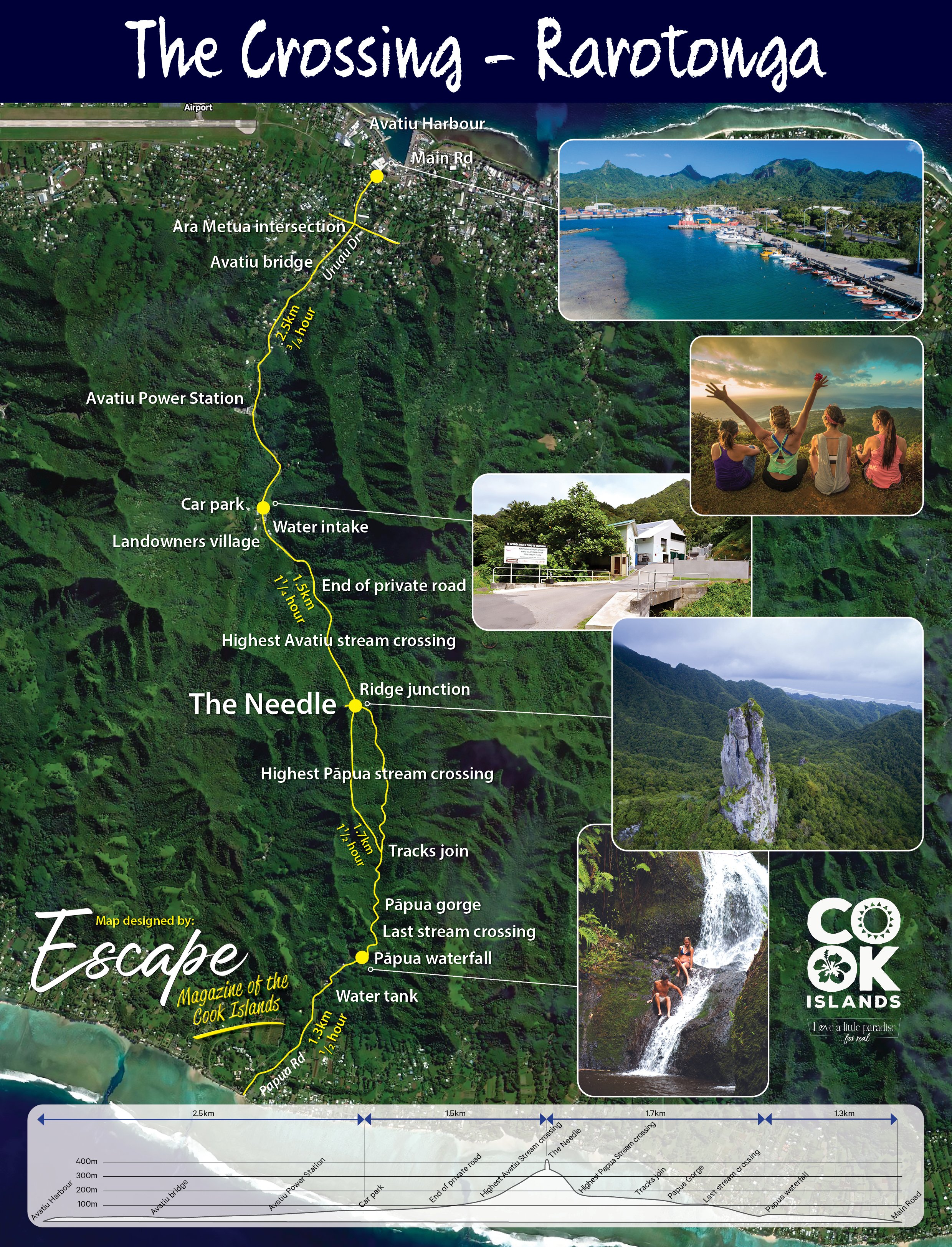
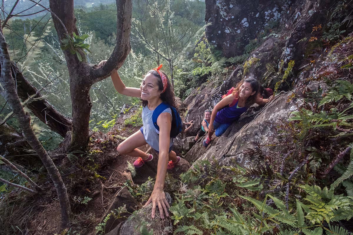
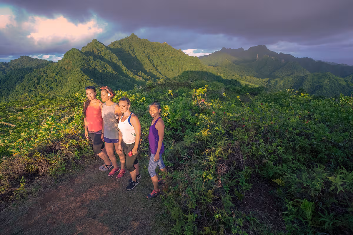
The Cross Island Trek on Rarotonga is true to its name as it does cross the entire island! It’s recommended that you begin the trail in the North and head South. Taking the public bus (that goes clockwise and anti-clockwise) is the best option but if you do have a car, driving would bring you closer to the trailheads.The trek is marked with orange markers for experienced trekkers who want to do this hike on their own. For those interested in a fully guided tour, explore Maunga Tours' Cross Island Trek.
As the trek ends at the Papua Waterfall (Wigmores Waterfall), feel free to take a dip and cool off after the hike. Please note that water is dependant on if it has been raining days prior to your hike.
If you decide to just do a hike up to “The Needle” (Te Rua Manga) you can drive up to the North side, trek up to the summit and return back the same way you went up.
The North Trailhead: Located in Avarua, you can take the bus here from almost anywhere on the island. Track down the Pandanus Gas Station (behind Sea Salt Takeaway) and walk straight up the road behind it. Look for Uraua Drive and carry on until the end of the road. You’ll see the trailhead sign and a map.
The South Trailhead: The South side of the trail starts (or ends) at Wigmores Waterfall, at the end of Papua Road on the South side of the island. To drive up the road to the waterfall, you’ll be asked for a donation ($2 for bikes and $5 for cars/trucks). If you’re ending your trek this way, there’s no need to donate. Please note that you will see a warning sign recommending starting the trail from the other direction but this is not necessary as you can start from the South trailhead.
Raemaru Trek (Raemaru, 350m) Moderate | 3.1km return | 90 mins average time | 15m rock climb to summit
The starting point for the Raemaru Trek is located on the back road in Arorangi. From the main road, locate Friendly Mart Convenience Store and take the inland road. Once you come to the backroad intersection, turn right following the yellow marked signs ‘Raemaru Trek’. Take another inland road in 80m (look for the yellow Raemaru sign). Follow to the end until you come to the start of the trek. Park on the side and off the road as this is a thoroughfare for inland residents.
Follow the orange markers on this trail.
QR Code self-guided tour is now available. All you need is a smartphone with a Vodafone visitor SIM card. You can purchase a visitor SIM card with Vodafone for $49 at the airport, Avarua or in Muri Beach.
There is also a guided tour offered by Adventure Cook Islands.